gdal浅尝篇
1.gdal背景知识
-
GDAL主要提供了三大类数据的支持:栅格数据,矢量数据以及空间网络数据(Geographic
Network Model)。 -
GDAL不但提供了API借口方便开发人员自定义自己的功能,而且还提供了一系列实用工具(Command
Line
Tools)可以实现方便快速的空间数据处理。我们可以使用这些实用工具,结合Linux
Shell脚本或者Windows批处理脚本进行大批量空间数据的批量处理。
- gdal实现数据格式转换
-
例子:shp转换为json
-
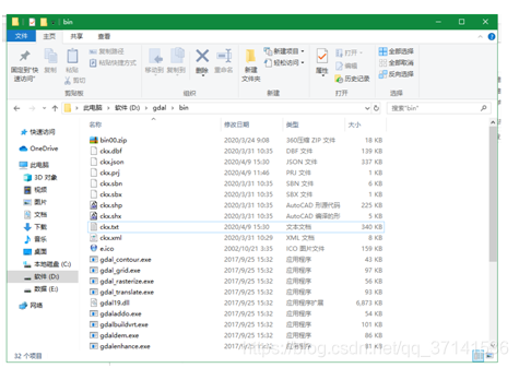
复制需要转json的矢量文件到:并且改名为英文(例如ckx)
-
打开里面文件为:shp转json 教程.doc
![[外链图片转存失败,源站可能有防盗链机制,建议将图片保存下来直接上传(img-lD5ytWGS-1587891205945)(media/b82c03f7586db287d6be2bb759aa933a.png)]](https://img-blog.csdnimg.cn/20200426165441142.png)
-
ogr2ogr -f “GeoJSON” ckx.json ckx.shp
-
然后在C:\Windows\System32\cmd.exe路径下打开cmd
-
运行打开修改后的这个:ogr2ogr -f “GeoJSON” ckx.json ckx.shp
-
会生成一个json文件在该路径下,然后用记事本打开,另存
![[外链图片转存失败,源站可能有防盗链机制,建议将图片保存下来直接上传(img-OuIFGd32-1587891205947)(media/7e5745caa282aa0961ac04cdb3182b18.png)]](https://img-blog.csdnimg.cn/2020042616550388.png?x-oss-process=image/watermark,type_ZmFuZ3poZW5naGVpdGk,shadow_10,text_aHR0cHM6Ly9ibG9nLmNzZG4ubmV0L3FxXzM3MTQxNTM2,size_16,color_FFFFFF,t_70)
-
一定改为utf-8;
-
到此使用gdal转换数据为json格式 完成。
-
其他格式数据转换
-
shape 转mapinfo文件
-
ogr2ogr -f “MapInfo File” -fieldTypeToString “Integer64” road Railway.shp
-
shape转GeoJSON格式
-
ogr2ogr -f “GeoJSON” -fieldTypeToString “Integer64” road Railway.shp
-
shape转wkt格式
-
ogr2ogr -lco “GEOMETRY=AS_WKT” -lco “SEPARATOR=TAB” -f CSV railway.csv -sql
“select LUA_ID from LandUseArea” LandUseArea.shp -
Shapez转wkt格式:ogr2ogr -lco “GEOMETRY=AS_WKT” -f CSV TAZ2.csv TAZ2.shp
- 使用arcpy代码实现shp转换为wkt
-
from osgeo import ogr
-
shapefile = r"shp\BOUA.shp"
-
driver = ogr.GetDriverByName(“ESRI Shapefile”)
-
dataSource = driver.Open(shapefile, 0)
-
layer = dataSource.GetLayer()
-
layerDefinition = layer.GetLayerDefn()
-
#获取字段名称列表
-
fields = []
-
for i in range(layerDefinition.GetFieldCount()):
-
fields.append(layerDefinition.GetFieldDefn(i).GetName())
-
print(fields)
-
#获取字段值和相应的几何
-
for feature in layer:
-
name = feature.GetField(“NAME”)
-
pac = feature.GetField(“PAC”)
-
geom = feature.GetGeometryRef()
-
geomwkt = geom.ExportToWkt()
-
print("%s;%s;%s\n"%(name,pac,geomwkt))
- 使用代码将wkt转换为shp
-
import osr
-
import ogr
-
outShapefile = r"aa4.shp"
-
tabletxt = r"data.txt"
-
outDriver = ogr.GetDriverByName(“ESRI Shapefile”)
-
# Create the output shapefile
-
outDataSource = outDriver.CreateDataSource(outShapefile)
-
#设置投影
-
srs = osr.SpatialReference()
-
srs.ImportFromEPSG(4326)
-
outLayer = outDataSource.CreateLayer(“states_extent”,
srs,geom_type=ogr.wkbPolygon) -
# 创建3个字段并设置类型和长度
-
aField = ogr.FieldDefn(“A”, ogr.OFTString)
-
aField.SetWidth(5)
-
outLayer.CreateField(aField)
-
bField = ogr.FieldDefn(“B”, ogr.OFTString)
-
bField.SetWidth(18)
-
outLayer.CreateField(bField)
-
cField = ogr.FieldDefn(“C”, ogr.OFTString)
-
cField.SetWidth(100)
-
outLayer.CreateField(cField)
-
#创建几何
-
featureDefn = outLayer.GetLayerDefn()
-
def addPoly(a,b,c,wktpoly):
-
feature = ogr.Feature(featureDefn)
-
feature.SetGeometry(wktpoly)
-
feature.SetField(“A”, a)
-
feature.SetField(“B”, b)
-
feature.SetField(“C”, c)
-
outLayer.CreateFeature(feature)
-
feature = None
-
f = open(tabletxt,‘r’)
-
#文件可能比较大,逐行读取
-
line = f.readline()
-
while line:
-
a,b,c,wktstr = line.split(";")
-
wktpoly = ogr.CreateGeometryFromWkt(wktstr)
-
addPoly(a,b,c, wktpoly)
-
line = f.readline()
-
f.close()
-
outDataSource = None
- 采用arcgis中字段计算器来计算wkt参数
打开shp文件的字段——添加文本类型字段——字段长度为4000——计算窗口示意如下:
![[外链图片转存中...(img-OYWr1Gaq-1587891205951)]](https://img-blog.csdnimg.cn/20200426165547349.png?x-oss-process=image/watermark,type_ZmFuZ3poZW5naGVpdGk,shadow_10,text_aHR0cHM6Ly9ibG9nLmNzZG4ubmV0L3FxXzM3MTQxNTM2,size_16,color_FFFFFF,t_70)
同理还可计算:!SHAPE.JSON!
