1 版本
2 相关配置
//前端的地理空间分析库,处理各种地图算法

npm i @turf/turf
3 Openlayers图形与图形Turf之间的互相转换
使用策略模式进行实现:
/**
 * 策略模式,不同类型返回不同的Turf几何图形
 */
export const mCoords2TurfGeom = {
    Point: function (coords) {
        return turf.point(coords);
    },
    MultiPoint: function (coords) {
        return turf.multiPoint(coords);
    },
    LineString: function (coords) {
        return turf.lineString(coords);
    },
    MultiLineString: function (coords) {
        return turf.multiLineString(coords);
    },
    Polygon: function (coords) {
        return turf.polygon(coords);
    },
    MultiPolygon: function (coords) {
        return turf.multiPolygon(coords);
    },
}
4 openlayers的要素点击事件
基于地图的"singleclick"点击事件拾取要素:
/**
* 选择要素
* @param {*} map 地图对象
* @param {*} type 事件类型
* @param {*} layerFilter 图层山筛选函数
* @param {*} cb1 选中要素回调
* @param {*} cb2 未选中要素回调
* @returns 事件Key
*/
export function mapOnFeature(map, type, layerFilter, cb1, cb2) {
const key = map.on(type, function (e) {
map.forEachFeatureAtPixel(e.pixel, function (feature, layer) {
if (feature && layer) {
cb1 && cb1(feature);
} else {
cb2 && cb2();
}
}, {
layerFilter: layerFilter,
hitTolerance: 5
});
});
return key;
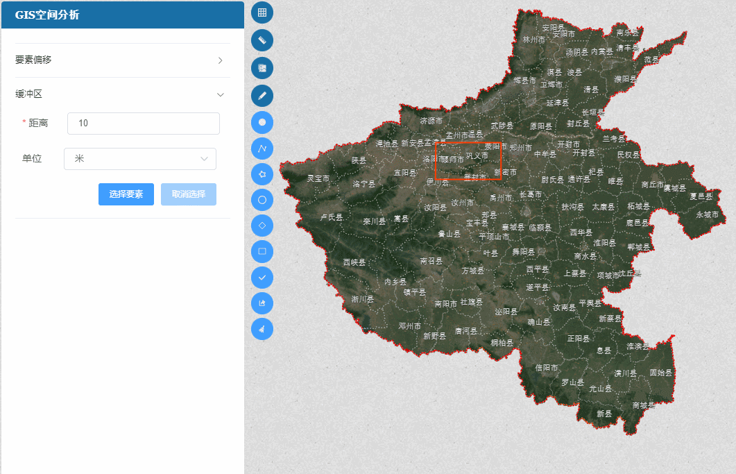
}5 进行缓冲区分析
import * as turf from "@turf/turf";

// 图层筛选
lFilter(layer) {
      // return layer;
      return layer.get("title") === "草图图层";
},

// 进行缓冲区分析
bufferF(feature) {
      const geometry = feature.getGeometry();
      const type = geometry.getType();
      geometry.transform("EPSG:3857", "EPSG:4326");
      const coords = geometry.getCoordinates();

      const tf = mCoords2TurfGeom[type](coords);
      // 缓冲区分析,turf必须使用wgs84经纬度坐标
      const tbf = turf.buffer(tf, this.mBuffer.distance, {
        units: this.mBuffer.unit,
      });
      const obf = new GeoJSON().readFeature(tbf);

      obf.getGeometry().transform("EPSG:4326", "EPSG:3857");
      geometry.transform("EPSG:4326", "EPSG:3857");
      this.pDrawLayer.getSource().addFeature(obf);
},

mBufferKey = mapOnFeature(this.pMap,"singleclick",this.lFilter,this.bufferF);
6 实现界面及效果图