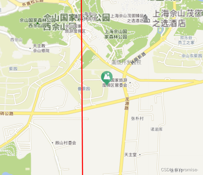
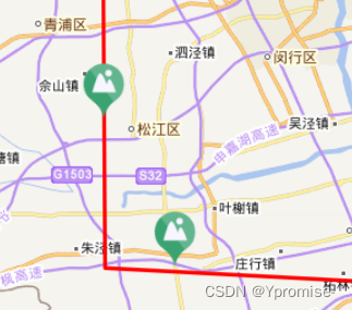
问题: 层级小的时候点击确实是在线上,但是当放大后,marker就不在线上了。

原因:
层级小的时候点击的经纬度,位置是眼睛看到的, 放大后就不是理想要的位置,这时候跟标注的偏移是没有关系的,因为我们鼠标点的位置就是所展示的。如果我们地图放的很大再去点,这时候的maker 就是非常准确的了。
解决思路:
采用turf的 nearestPointOnLine 方法, 计算获取点距离线图层的交点。
代码片段:
drawa(){
            // 线:坐标点
            var latlngs = [
                [31.537628173828125,121.190185546875],
                [30.878448486328125,121.19430541992188],
                [30.839996337890625,121.92901611328125]
            ];

            let map = this.map;  //获取map地图

            let lineLayer = L.featureGroup([])  // 创建线图层
            map.addLayer(lineLayer)
            // 绘制且添加
            var polyline = L.polyline(latlngs, {color: 'red'}).addTo(lineLayer);
            // 跳到线的范围
            //map.fitBounds(polyline.getBounds());

            lineLayer.on("click",function(e){
                console.log(e);
                var Icon = L.icon({
                        // iconUrl:require(`../../../assets/images/bigscreen/red.png`),
                        iconUrl:require(`./abc.png`),

                        iconSize: [50, 50], // size of the icon
                        // 左移 上移
                        iconAnchor: [25, 49], // 偏移量
                    });

                let latlng = e.latlng;
                let linejson = e.layer.toGeoJSON();  //获取线图层点集
                let pt = turf.point([latlng.lng, latlng.lat], {"marker-color": "F00"});
                // 计算交点
                let snapped = turf.nearestPointOnLine(linejson, pt, {units: 'kilometers'});
                console.log("snapped",snapped)

                let center = snapped.geometry.coordinates;
                console.log("center",center);

                L.marker([center[1],center[0]], { icon: Icon }).addTo(map);

            })
        },
实现结果:

无论地图放多大,点始终在线上,因为绘制的经纬度就和线的交点。
随笔小记(来源公司大佬)