index.html中引入天地图api
<script type="text/javascript" src="https://api.tianditu.gov.cn/api?v=4.0&tk=你的key"></script>
map.vue中初始化天地图
//初始化天地图
initTMap() {


  const T = window.T;
  // 3.初始化地图对象
  this.tMap = new T.Map("containerT", {

    });
  // 4.设置显示地图的中心点和级别
  this.tMap.centerAndZoom(new T.LngLat(116.397590, 39.908776), 13);
  // 5.创建地图类型控件
  const ctrl = new T.Control.MapType([{


    title: '地图',
    icon: 'http://api.tianditu.gov.cn/v4.0/image/map/maptype/vector.png',                     //地图控件上所要显示的图层图标(默认图标大小80x80)
    layer: window.TMAP_NORMAL_MAP
  }, {


    title: '卫星',
    icon: 'http://api.tianditu.gov.cn/v4.0/image/map/maptype/satellite.png',
    layer: window.TMAP_SATELLITE_MAP
  }]);
  // 6.将控件添加到地图,一个控件实例只能向地图中添加一次。
  this.tMap.addControl(ctrl);
  // 7.创建坐标,通常是调取接口获得经纬度
  const point = new T.LngLat(116.397590, 39.908776);
  // 8.创建覆盖使用的图标
  const icon = new T.Icon({


    iconUrl: '../marker-red.png',
    iconSize: new T.Point(27, 27),
    iconAnchor: new T.Point(10, 25)
  });
  // 9. 创建在该坐标上的一个图像标注实例
  const marker = new T.Marker(point, icon);
  // 10.将覆盖物添加到地图中,一个覆盖物实例只能向地图中添加一次
  this.tMap.addOverLay(marker);
}
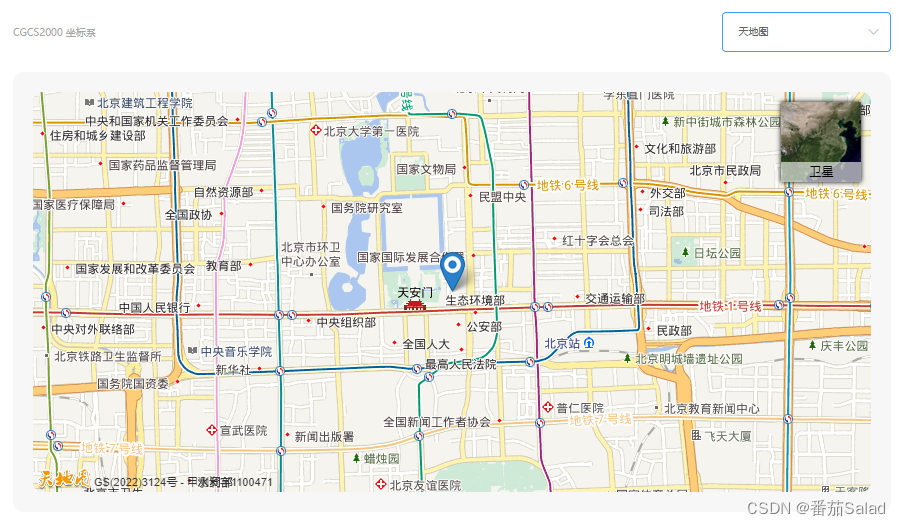
出现问题:
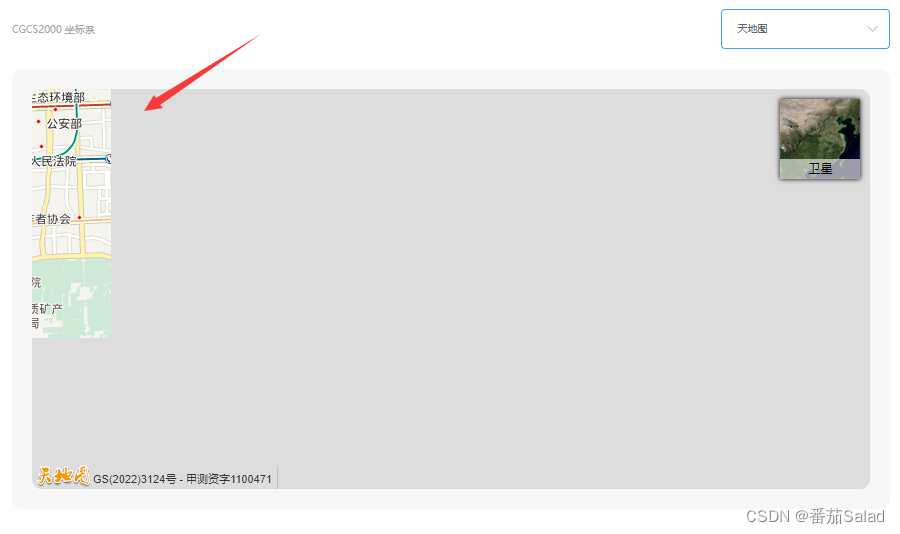
解决方法:
直接用延迟包裹即可
setTimeout(()=>{


	初始化地图代码
},1500) //延迟多久随你调
如下:
最好加个element-ui的loading加载的时候好看点
//初始化天地图
initTMap() {


  setTimeout(()=>{


    const T = window.T;
  // 3.初始化地图对象
  this.tMap = new T.Map("containerT", {

    });
  // 4.设置显示地图的中心点和级别
  this.tMap.centerAndZoom(new T.LngLat(116.397590, 39.908776), 13);
  // 5.创建地图类型控件
  const ctrl = new T.Control.MapType([{


    title: '地图',
    icon: 'http://api.tianditu.gov.cn/v4.0/image/map/maptype/vector.png',                     //地图控件上所要显示的图层图标(默认图标大小80x80)
    layer: window.TMAP_NORMAL_MAP
  }, {


    title: '卫星',
    icon: 'http://api.tianditu.gov.cn/v4.0/image/map/maptype/satellite.png',
    layer: window.TMAP_SATELLITE_MAP
  }]);
  // 6.将控件添加到地图,一个控件实例只能向地图中添加一次。
  this.tMap.addControl(ctrl);
  // 7.创建坐标,通常是调取接口获得经纬度
  const point = new T.LngLat(116.397590, 39.908776);
  // 8.创建覆盖使用的图标
  const icon = new T.Icon({


    iconUrl: '../marker-red.png',
    iconSize: new T.Point(27, 27),
    iconAnchor: new T.Point(10, 25)
  });
  // 9. 创建在该坐标上的一个图像标注实例
  const marker = new T.Marker(point, icon);
  // 10.将覆盖物添加到地图中,一个覆盖物实例只能向地图中添加一次
  this.tMap.addOverLay(marker);
    this.tMap.checkResize()
  },1500)
}
已解决