之前被同事紧急问起,location出来的经纬度怎么自已算出来方位角和距离。如果是自已算的话,一般来说是前后两秒经纬度进行计算。我在android 系统源码也看到计算方式。在这里进行贴出来,记录一下。
1、location 类
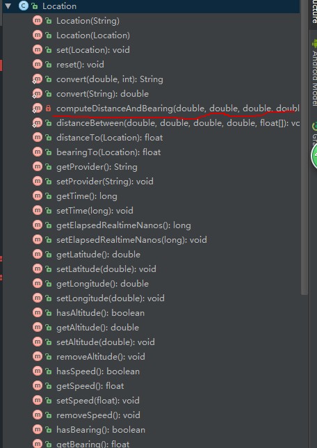
这个是location类。有android api源码都能找到的。
2、关键代码
    private static void computeDistanceAndBearing(double lat1, double lon1,
        double lat2, double lon2, float[] results) {
        // Based on http://www.ngs.noaa.gov/PUBS_LIB/inverse.pdf
        // using the "Inverse Formula" (section 4)

        int MAXITERS = 20;
        // Convert lat/long to radians
        lat1 *= Math.PI / 180.0;
        lat2 *= Math.PI / 180.0;
        lon1 *= Math.PI / 180.0;
        lon2 *= Math.PI / 180.0;

        double a = 6378137.0; // WGS84 major axis
        double b = 6356752.3142; // WGS84 semi-major axis
        double f = (a - b) / a;
        double aSqMinusBSqOverBSq = (a * a - b * b) / (b * b);

        double L = lon2 - lon1;
        double A = 0.0;
        double U1 = Math.atan((1.0 - f) * Math.tan(lat1));
        double U2 = Math.atan((1.0 - f) * Math.tan(lat2));

        double cosU1 = Math.cos(U1);
        double cosU2 = Math.cos(U2);
        double sinU1 = Math.sin(U1);
        double sinU2 = Math.sin(U2);
        double cosU1cosU2 = cosU1 * cosU2;
        double sinU1sinU2 = sinU1 * sinU2;

        double sigma = 0.0;
        double deltaSigma = 0.0;
        double cosSqAlpha = 0.0;
        double cos2SM = 0.0;
        double cosSigma = 0.0;
        double sinSigma = 0.0;
        double cosLambda = 0.0;
        double sinLambda = 0.0;

        double lambda = L; // initial guess
        for (int iter = 0; iter < MAXITERS; iter++) {
            double lambdaOrig = lambda;
            cosLambda = Math.cos(lambda);
            sinLambda = Math.sin(lambda);
            double t1 = cosU2 * sinLambda;
            double t2 = cosU1 * sinU2 - sinU1 * cosU2 * cosLambda;
            double sinSqSigma = t1 * t1 + t2 * t2; // (14)
            sinSigma = Math.sqrt(sinSqSigma);
            cosSigma = sinU1sinU2 + cosU1cosU2 * cosLambda; // (15)
            sigma = Math.atan2(sinSigma, cosSigma); // (16)
            double sinAlpha = (sinSigma == 0) ? 0.0 :
                cosU1cosU2 * sinLambda / sinSigma; // (17)
            cosSqAlpha = 1.0 - sinAlpha * sinAlpha;
            cos2SM = (cosSqAlpha == 0) ? 0.0 :
                cosSigma - 2.0 * sinU1sinU2 / cosSqAlpha; // (18)

            double uSquared = cosSqAlpha * aSqMinusBSqOverBSq; // defn
            A = 1 + (uSquared / 16384.0) * // (3)
                (4096.0 + uSquared *
                 (-768 + uSquared * (320.0 - 175.0 * uSquared)));
            double B = (uSquared / 1024.0) * // (4)
                (256.0 + uSquared *
                 (-128.0 + uSquared * (74.0 - 47.0 * uSquared)));
            double C = (f / 16.0) *
                cosSqAlpha *
                (4.0 + f * (4.0 - 3.0 * cosSqAlpha)); // (10)
            double cos2SMSq = cos2SM * cos2SM;
            deltaSigma = B * sinSigma * // (6)
                (cos2SM + (B / 4.0) *
                 (cosSigma * (-1.0 + 2.0 * cos2SMSq) -
                  (B / 6.0) * cos2SM *
                  (-3.0 + 4.0 * sinSigma * sinSigma) *
                  (-3.0 + 4.0 * cos2SMSq)));

            lambda = L +
                (1.0 - C) * f * sinAlpha *
                (sigma + C * sinSigma *
                 (cos2SM + C * cosSigma *
                  (-1.0 + 2.0 * cos2SM * cos2SM))); // (11)

            double delta = (lambda - lambdaOrig) / lambda;
            if (Math.abs(delta) < 1.0e-12) {
                break;
            }
        }

        float distance = (float) (b * A * (sigma - deltaSigma));
        results[0] = distance;
        if (results.length > 1) {
            float initialBearing = (float) Math.atan2(cosU2 * sinLambda,
                cosU1 * sinU2 - sinU1 * cosU2 * cosLambda);
            initialBearing *= 180.0 / Math.PI;
            results[1] = initialBearing;
            if (results.length > 2) {
                float finalBearing = (float) Math.atan2(cosU1 * sinLambda,
                    -sinU1 * cosU2 + cosU1 * sinU2 * cosLambda);
                finalBearing *= 180.0 / Math.PI;
                results[2] = finalBearing;
            }
        }
    }
传入两个经纬度值,这个就不用高程。不用做过多的解释了。
源码封装的调用方式
方位角(航向角)
    /**
     * Returns the approximate initial bearing in degrees East of true
     * North when traveling along the shortest path between this
     * location and the given location.  The shortest path is defined
     * using the WGS84 ellipsoid.  Locations that are (nearly)
     * antipodal may produce meaningless results.
     *
     * @param dest the destination location
     * @return the initial bearing in degrees
     */
    public float bearingTo(Location dest) {
        synchronized (mResults) {
            // See if we already have the result
            if (mLatitude != mLat1 || mLongitude != mLon1 ||
                            dest.mLatitude != mLat2 || dest.mLongitude != mLon2) {
                computeDistanceAndBearing(mLatitude, mLongitude,
                    dest.mLatitude, dest.mLongitude, mResults);
                mLat1 = mLatitude;
                mLon1 = mLongitude;
                mLat2 = dest.mLatitude;
                mLon2 = dest.mLongitude;
                mDistance = mResults[0];
                mInitialBearing = mResults[1];
            }
            return mInitialBearing;
        }
    }
距离:
    /**
     * Returns the approximate distance in meters between this
     * location and the given location.  Distance is defined using
     * the WGS84 ellipsoid.
     *
     * @param dest the destination location
     * @return the approximate distance in meters
     */
    public float distanceTo(Location dest) {
        // See if we already have the result
        synchronized (mResults) {
            if (mLatitude != mLat1 || mLongitude != mLon1 ||
                dest.mLatitude != mLat2 || dest.mLongitude != mLon2) {
                computeDistanceAndBearing(mLatitude, mLongitude,
                    dest.mLatitude, dest.mLongitude, mResults);
                mLat1 = mLatitude;
                mLon1 = mLongitude;
                mLat2 = dest.mLatitude;
                mLon2 = dest.mLongitude;
                mDistance = mResults[0];
                mInitialBearing = mResults[1];
            }
            return mDistance;
        }
    }
都是调用这个方法进行计算的computeDistanceAndBearing。
想多了解android location方面: